
April 30, 2021
A Land Use Plan (LUP) has been mapped for the protected Mt. Mantalingahan in Palawan to ensure its preservation and the optimum development of its resources economically valued at $5.5 billion.
The Department of Environment and Natural Resources (DENR) reported that 206,567 hectares of Mt. Mantalingahan’s protected landscape had already been zoned.
This is under DENR’s technical assistance program called “Protect Wildlife Project” funded by the United States Agency for International Development ((USAID).
The zoned area also includes forest land outside the protected area of 153,836 hectares.
DENR said mapping of Mt Mantalingahan Protected Landscape (MMPL) is a powerful tool in defining which activities are appropriate for each zone. It prescribes what is allowed in each area.
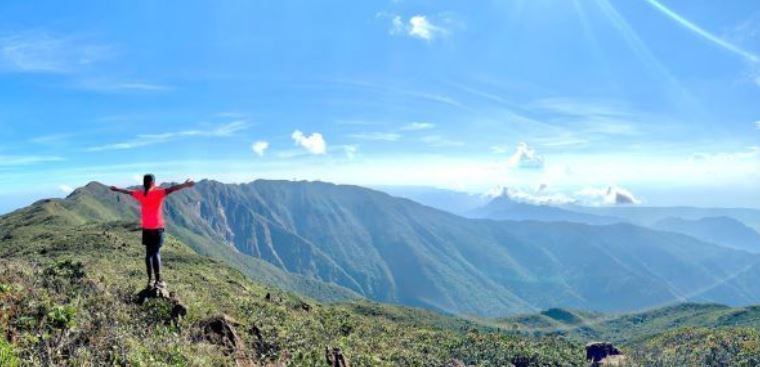
With its 120,457 hectares of forest, Mt. Matalingahan is the headwater for 33 watersheds.
It is important to preserve the habitat of many important species of animals in Mt. Matalingahan–the Philippine cockatoo, the talking mynah, the blue-naped parrot, and the Philippine Pangolin, and many other highly endangered wildlife.
Production area totaling to 82,469 hectares of protected area and 71,367 hectares of conservation area have also been designated under the FLUP (Forest Land Use Plan) of Southern Palawan.
DENR said the Protect Wildlife Project targets to conserve around 750,000 hectares of biologically significant sites. These are protected areas, forestlands, watersheds, mangrove forests, and coastal and marine areas.
“The project leveraged P368 million of commitments from private and public sector partners to fund conservation activities including support for sustainable livelihood, and social enterprises,” said DENR.
Mt. Matalingahan is the highest peak in Palawan. It straddles around the towns of Bataraza, Brooke’s Point, Rizal, Quezon, and Sofronio Espanola.
It plays an important role as a deterrent to flashfloods and other destructive forces.
Moreover, Mt. Matalingahan even faces natural and man-made threats from illegal logging, wildlife poaching, mining, and kaingin (slash and burn).
It also faces risks of high poverty incidence that cause people to destroy the forest; unclear or inconsistent regulatory policies on resource uses; communities that lack tenure rights; weak enforcement systems; and the vulnerability to climate risks such as drought and intense rainfall, according to the USAID.
The Protect Wildlife Project aligned the Land Use Plan with prevailing policies.
“Protect Wildlife found that there were several areas where actual land uses differed from what policies prescribe, thereby causing much of the degradation within the protected area and adjoining forest lands,” said USAID.
The LUP is now compliant to the policies on Environmentally Critical Areas Network (ECAN) strategy for Palawan, National Integrated Protected Areas Systems Act, Forestry Code, the Local Government Code, and the Indigenous Peoples Rights Act.
Land use includes forest lands which are designated into protection, conservation, and production areas. Production areas are further divided into sub-zones such as agriculture, tourism, and special areas.
“Each zone and sub-zone has corresponding evidence-based land and resource use prescriptions—the rules for how an area of land may be legally used. Zoning decisions are derived from spatial analysis but also consider socioeconomic and political realities,” reported USAID.
“Land use zoning provides a solid basis for LGUs (local government units) and the DENR to make informed decisions for investments on natural assets enhancement, restoration, basic infrastructure, social services and enterprises.”
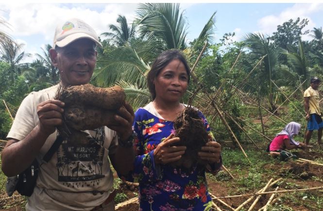
DENR said the project has partners for livelihood programs. These are Lutheran World Relief, Abraham Holdings, Inc., and Sunlight Foods Corporation. They are supporting establishment of enterprises in five LGUs in the MMPL.
Also participating now in an ube (purple yam) production are upland communities in tenured areas in Bataraza, Brooke’s Point and Sofronio Española.
Fourteen communities with a total of 1,500 households are into conservation agriculture and agroforestry. (Melody Mendoza Aguiba)
